Daily Read / Canada and Community
Canada and Community · Find the main idea and supporting details, and read a map described in words
What Is the Oak Ridges Moraine? The Ridge That Stores Water
North of Toronto, a 160 km ridge of sand and gravel soaks up rain. Find the main idea, picture the map, and see how Ontario's plan protects it.
Device/browser voice. Pronunciation and availability vary.
A long hill north of the city
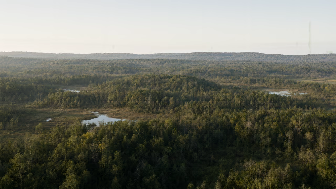
If you travel north from Toronto, the flat land near Lake Ontario starts to rise into rolling hills. Those hills belong to the Oak Ridges Moraine. The Government of Ontario describes it as an irregular ridge that stretches 160 kilometres, from the Trent River in the east to the Niagara Escarpment in the west.
The moraine is more than a pretty view. Rain and melting snow that fall on it soak deep into the ground, and many rivers begin in its hills. That is why people call it the ridge that stores water for the Greater Toronto Area.[1]
Left behind by ice
A moraine is a ridge of sand, gravel and other material left behind by a glacier, a huge sheet of ice that moves slowly over land. Parks Canada says the Oak Ridges Moraine formed about 12,000 years ago, near the end of the last ice age. As the ice melted and pulled back, it dropped a large amount of sediment along a 160 km-long ridge.
The Canadian Encyclopedia traces the moraine's beginnings back about 13,000 years. The two sources give slightly different numbers, but they agree on the big idea: melting glaciers built the moraine at the end of the last ice age.[3]
Reading the map in words
Picture a map with Lake Ontario along the bottom. About 60 kilometres north of the lake, draw a long, bumpy band running from left to right, parallel to the shore. The west end of the band is near Caledon and the Niagara Escarpment. The east end is near the Trent River. In some places the band is about 14.5 kilometres wide; at its narrowest point, west of Rice Lake, it is less than half a kilometre wide.
Now add arrows for water. Rivers on the south side of the band flow down toward Lake Ontario. Rivers on the north side flow the other way, toward Lake Simcoe, Georgian Bay and the Trent River. Because water splits in two directions at the top of the ridge, the moraine is called a divide.[2]
A giant sponge of sand and gravel
Most of the moraine is made of sand and gravel, which have lots of tiny spaces between the grains. The Oak Ridges Moraine Land Trust explains that this material absorbs water quickly, so rain that falls on the moraine often seeps straight down into its sandy core. Over time, that water refills aquifers, underground layers that hold groundwater. Parks Canada adds that the moraine's sandy soil can store and filter large amounts of groundwater.
The moraine is also where many streams start. The Rouge and Little Rouge rivers begin in its hills, according to Parks Canada. The Land Trust's page counts the rivers and streams that begin on the moraine as 64, 65 and 66 in different places, so a careful summary is "more than 60".[4]
Homes for plants and animals
The Canadian Encyclopedia calls the moraine one of the region's few remaining green corridors, a strip of natural land that plants and animals can live in and move along. It lists 1,171 plant species, 51 mammal species and 73 fish species, along with 88 species at risk.
Some habitats come straight from the ice age. A kettle lake forms where a big block of ice was left half buried in sand and gravel after a glacier pulled back. When the ice melted, it left a hollow that filled with groundwater.[2]
What Ontario's plan does
In 2001, Ontario passed the Oak Ridges Moraine Conservation Act. The Oak Ridges Moraine Conservation Plan followed in 2002, and the current version dates from 2017. The plan covers about 190,000 hectares and sorts the land into four kinds of areas. Natural Core Areas (38 percent) have the most important natural features, and only existing uses, farming and very limited new uses are allowed there. Natural Linkage Areas (24 percent) connect the core areas and run along rivers and streams. Countryside Areas (30 percent) are farmland and rural land. Settlement Areas (8 percent) are existing communities, where towns plan urban uses.
The plan also asks municipalities to prepare watershed plans, water budgets and water conservation plans, and it limits hard surfaces such as pavement outside Settlement Areas. People hold different views about how land on the moraine should be used. This article explains what the plan says; it does not take a side.[1]
Fast lesson
Use these checks before you answer the practice questions.
Before the questions, ask your child to say what every heading has in common. Then ask for one detail from each section that supports that idea.
The map section is written so it can be drawn. Let your child sketch it on paper, then compare with a real map of southern Ontario if you have one.
The plan section describes what the plan does. If your child asks whether building on the moraine is good or bad, talk about what each side cares about rather than giving one answer.
Common mistakes
Why this fails: A moraine is a ridge of sand, gravel and rock left by a glacier. It holds water underground, but it is land.
Why this fails: 'It is 160 kilometres long' is a detail. The main idea has to cover the whole article.
Why this fails: The plan sorts land into four areas. Existing communities are in Settlement Areas, and farming continues in several areas.
Word Lab
Use the meaning, hear the word, then try it in your own sentence.
moraine
nouna ridge of sand, gravel and rock left behind by a glacier
The Oak Ridges Moraine runs north of Toronto.
glacier
nouna huge, thick sheet of ice that moves slowly over land
A melting glacier dropped sand and gravel along the ridge.
ridge
nouna long, narrow stretch of high land
The ridge stretches 160 kilometres.
sediment
nounsand, mud and small stones carried and dropped by water, wind or ice
The retreating ice left sediment along the ridge.
groundwater
nounwater stored underground in the spaces between soil, sand and rock
Sandy soil can store and filter groundwater.
aquifer
nounan underground layer of sand, gravel or rock that holds water
Rain seeps down and refills the aquifer.
headwaters
nounthe place where a river or stream begins
The Rouge River's headwaters are in the moraine's hills.
divide
nounhigh land that separates water flowing in one direction from water flowing in another
The moraine is a divide between rivers flowing south and north.
habitat
nounthe natural home of a plant or animal
Kettle lakes and forests are habitats on the moraine.
corridor
nouna long strip of land that connects places, such as natural areas for wildlife
The moraine is a green corridor for animals.
conservation
nounthe careful protection of nature, water or land
The plan is called a conservation plan.
seep
verbto flow slowly through small openings
Rain seeps down into the sandy core.
Check your understanding
Choose an answer, explain your choice, and then check. Hints and retries are welcome.
Try the questions here. Public practice does not save a learning record.
Support · Find it in the text
Support · Find it in the text practice
Each answer is in the article. Point to the sentence.
1. How long is the Oak Ridges Moraine?
2. What is at the east end and the west end of the moraine?
3. About how long ago did Parks Canada say the moraine formed?
4. Name two rivers that begin in the moraine's hills.
5. In what year did Ontario pass the Oak Ridges Moraine Conservation Act?
6. What are the four kinds of areas in the plan?
Apply · Main idea and details
Apply · Main idea and details practice
Use the article to explain how and why.
7. Write the main idea of the article in one sentence.
8. Give two details that support the idea that the moraine matters for water.
9. Why does rain soak into the moraine instead of running off quickly?
10. What is a kettle lake, and how does it form?
11. Why might the plan limit hard surfaces such as pavement outside Settlement Areas?
12. What does a Natural Linkage Area do?
Reason · Draw the map
Reason · Draw the map practice
Turn words into a map, compare sources and apply what you learned.
13. Sketch the map from 'Reading the map in words'. Label Lake Ontario, the moraine, the Niagara Escarpment, the Trent River and Lake Simcoe.
14. On your sketch, draw arrows to show which way rivers flow on each side of the moraine.
15. The Canadian Encyclopedia calls the 2001 law the 'Oak Ridges Moraine Protection Act', but the Government of Ontario calls it the 'Oak Ridges Moraine Conservation Act'. Which name would you use, and why?
16. Is 'Natural Core Areas make up 38 percent of the plan area' a fact or an opinion?
17. A parking lot is built on sandy land on the moraine. Using the article, predict what might happen to rain that falls there.
Practice answer key
- 1. About 160 kilometres.
This is in 'A long hill north of the city'. - 2. The Trent River in the east and the Niagara Escarpment in the west.
The first and third sections both describe the ends. - 3. About 12,000 years ago.
This is in 'Left behind by ice'. - 4. The Rouge and the Little Rouge.
This is in 'A giant sponge of sand and gravel'. - 5. 2001.
This is in 'What Ontario's plan does'. - 6. Natural Core Areas, Natural Linkage Areas, Countryside Areas and Settlement Areas.
All four are listed in the last section. - 7. Example: The Oak Ridges Moraine is a ridge left by glaciers whose sand and gravel store water, start many rivers and support wildlife, and Ontario has a plan to protect it.
A strong main idea covers the whole article, not just one section. - 8. Examples: rain seeps into its sandy core and refills aquifers; its sandy soil stores and filters groundwater; more than 60 rivers and streams begin on it.
Details are facts that back up the main idea. - 9. Sand and gravel have many spaces between the grains, so water can seep down through them.
This is the 'sponge' idea in the fourth section. - 10. A lake in a hollow left when a block of ice, half buried in sand and gravel, melted after a glacier pulled back. The hollow filled with groundwater.
This is in 'Homes for plants and animals'. - 11. Pavement stops rain from soaking into the ground, and the moraine's job of storing water depends on rain soaking in.
Connect the plan to the 'sponge' section. The plan's own reason is about protecting water, which the article states generally. - 12. It connects Natural Core Areas and runs along rivers and streams.
Think of a linkage as a link in a chain. - 13. Lake Ontario at the bottom; a long east–west band about 60 km north of it; the Niagara Escarpment at the west (left) end; the Trent River at the east (right) end; Lake Simcoe north of the band.
Lake Simcoe is north because rivers on the north side flow toward it. The drawing is a simple sketch, not to scale. - 14. Arrows on the south side point down toward Lake Ontario; arrows on the north side point up toward Lake Simcoe, Georgian Bay or the Trent River.
This is what makes the moraine a divide. - 15. Use 'Conservation Act', because the government that passed the law is the most direct source for its official name.
When sources disagree on an official name, go to the organization that created it. - 16. A fact. It can be checked on the Government of Ontario's plan page.
Facts can be checked; opinions are beliefs or feelings. - 17. More of it would run off the pavement instead of soaking into the sand and refilling aquifers.
This is a prediction based on the sponge idea, not a fact reported about a real parking lot.
Related skills
Put it in your own words
This draft is not saved when you leave or refresh the page.
Check your own explanation
This is self-review, not automatic marking.
Compare with a model response
The Oak Ridges Moraine is important because it stores water for a large part of southern Ontario. It is a ridge of sand and gravel left by melting glaciers about 12,000 years ago, according to Parks Canada. On a map, it runs east to west for about 160 kilometres, roughly 60 kilometres north of Lake Ontario, from the Niagara Escarpment to the Trent River. Its sand and gravel soak up rain quickly, and the water seeps down to refill aquifers. More than 60 rivers and streams begin on the moraine, including the Rouge River. The moraine also gives homes to many plants and animals. Ontario's conservation plan sorts the land into four kinds of areas and limits pavement outside Settlement Areas.
Sources and revision notes
Source check: 2026-10-27. Grade guidance is an editorial suggestion, not a standardised reading score.
- Government of Ontario — Oak Ridges Moraine Conservation Plan (2017)
- The Canadian Encyclopedia — Oak Ridges Moraine
- Parks Canada — Rouge National Urban Park: Geology
- Oak Ridges Moraine Land Trust — Water and the Moraine
What changed in this edition?
The 160 km length, the Trent River and Niagara Escarpment ends, the 2001 Act, the 2002 plan regulation, the 2017 plan, the 190,000-hectare area, the four land designations with their percentages and allowed uses, and the watershed-plan and impervious-surface requirements come from the Government of Ontario's plan page. The 13,000-year origin, the 60 km distance from Lake Ontario, the Caledon end, the widths, the drainage directions, the green-corridor description and the species counts come from The Canadian Encyclopedia, which names the 2001 law the 'Oak Ridges Moraine Protection Act'; this lesson uses the Government of Ontario's name. The 12,000-year age, the sediment deposited along a 160 km ridge, the Rouge and Little Rouge headwaters and the sandy soil that stores and filters groundwater come from Parks Canada. The quick absorption of rain, seepage into the sandy core, aquifer recharge, the kettle-lake explanation and the counts of 64, 65 and 66 rivers and streams come from the Oak Ridges Moraine Land Trust; 'more than 60' is this lesson's summary of those counts. The map description is a simplified written sketch, not to scale. The article explains what the plan does and takes no position on development debates.